Cities are complex webs of places, people, and movement. Understanding how these pieces connect helps us plan better and build smarter. One way to do this is by using graph neural networks (GNNs), a type of AI that learns from networks instead of isolated data points.
Graphs show relationships clearly. Think of a city map where intersections are nodes and streets are edges. Add places like restaurants, schools, and hospitals as points of interest (POIs). Now imagine teaching a model to recognize what kind of place each POI is, just by looking at its location and connections.
This is exactly what happens when combining city2graph, OSMnx, and PyTorch Geometric. city2graph helps build graph structures from city data. OSMnx pulls real-world street maps and POI data from OpenStreetMap. PyTorch Geometric trains GNN models on this data to predict urban functions like whether a spot is a cafe or a school.
Having tools that work together means you can collect, clean, and analyze urban data in one workflow. If live data isn’t available, synthetic datasets simulate the city environment so the process keeps running. This flexibility is key for researchers or planners who want reliable results under different conditions.
Why Graph Neural Networks Matter for Urban Data
Traditional data models treat each location or feature separately. But cities are all about connections. GNNs capture that by passing information between nodes along edges. The model learns context — what surrounds a place, not just its own features.
This context-awareness improves predictions. For example, a restaurant is likely near other food businesses or busy streets. A hospital might be close to clinics and pharmacies. GNNs use this spatial and relational data to classify places more accurately than simple feature-based models.
Moreover, GNNs can work with heterogeneous graphs, which mix different types of nodes and connections. That means you can represent complex urban structures realistically, combining streets, buildings, and land uses in one graph.
Graph Embeddings and Real-World Applications
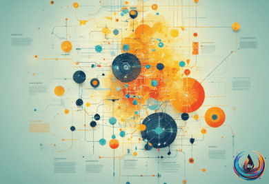
Graph embedding techniques turn these complex graphs into vectors. Vectors are just lists of numbers that machine learning models understand. This step preserves relationships and patterns from the graph while making the data easier to use.
Embeddings help with many tasks beyond urban planning. They are useful in fraud detection, supply chain optimization, and recommendation systems. For example, banks use GNNs to spot fraud rings by analyzing transaction networks. Retailers improve product recommendations by learning from user-item graphs.
In cities, embeddings can power traffic predictions, route optimization, and infrastructure planning. They reveal bottlenecks and vulnerable points in road networks. This insight helps authorities manage congestion and improve urban mobility.
Combining classical graph analysis tools like NetworkX with graph learning frameworks such as TGraphX or PyTorch Geometric gives you the best of both worlds. Use NetworkX for calculating graph metrics like shortest paths or centrality. Then feed those features into GNNs for deeper, context-aware learning.
This hybrid approach supports scalable, GPU-accelerated training while keeping the ability to explore and understand graph structures.
Urban AI Meets Multimodal Language Models
Beyond graphs, new AI tools like multimodal large language models (MLLMs) expand urban analysis. These models understand images and text together. For instance, ChatGPT has been used to extract building attributes from street view images.
This means AI can identify building types, heights, and ages just from photos. Such data is crucial for urban climate models and energy demand studies. It fills gaps in traditional datasets, which often lack fine detail on building characteristics.
Combining MLLMs with graph learning could unlock even richer urban insights. Imagine a system that reads city images, maps the street network, and predicts urban functions all at once. This integration opens new possibilities for smart city planning and sustainability.
AI is turning raw city data into actionable knowledge. From street layouts to business categories and building traits, it helps us understand cities as dynamic, interconnected systems. The future of urban science lies in these powerful graph and multimodal AI tools working together.
Based on
- A Coding Implementation on Spatial Graph Neural Networks for Urban Function Inference Using city2graph, OSMnx, and PyTorch Geometric — marktechpost.com
- Graph Neural Networks for Business: Python AI & GNN Use Cases — addwebsolution.com
- Graph Embedding Methods for Network Data Analysis – ITU Online IT Training — ituonline.com
- TGraphX vs NetworkX: Graph Analytics vs Graph Learning | TGraphX — tgraphx.com
- GIS and Agent-Based Modeling: June 2026 — gisagents.org